
Jižní Svahy Central Park in Zlín – Phase II
Location:
Zlín, Czech Republic
Client:
Statutory Town of Zlín
Project description:
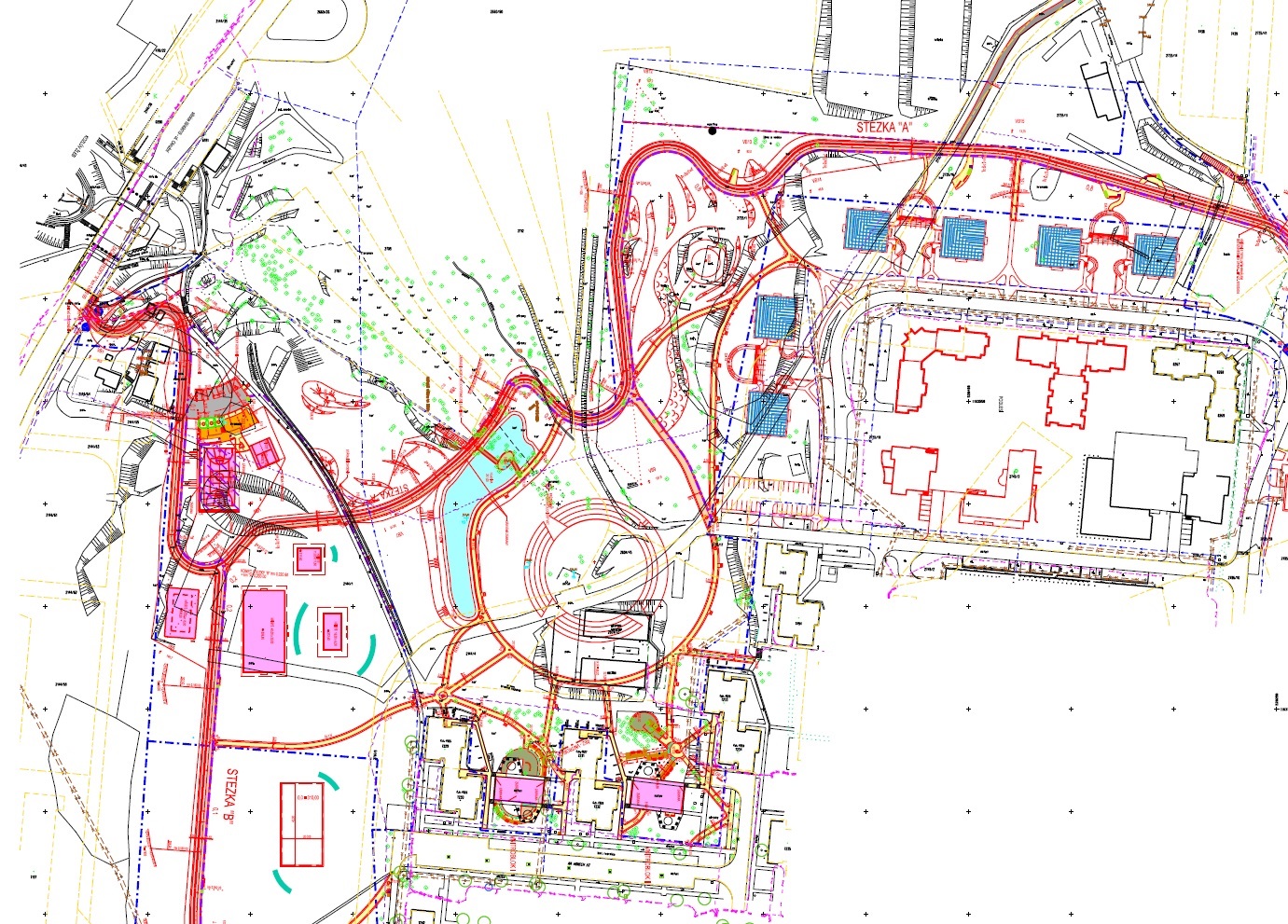
The project includes construction of Phase II of the Jižní Svahy Central Park in Zlín. The Park is situated on areas which shall serve as a bio-corridor and greenery zone according to the town zoning plan.
The park areas occupy mainly the western slope. They are surrounded by residential buildings and will be completely enclosed by future building development.
As for the park composition, it can be divided in three parts:
- North-eastern part – connection to the open landscape
- Central part – concentration of the park functions
- Western part – bio-corridor and sports facilities
All the above mentioned parts are connected with pedestrian and cycle path from the North-East to the South-West. The path is the principal traffic and composition component of the entire park. The service building is situated at the central point of the park, i.e. at the centre of both construction phases. However, the right choice of the building location collided with the ban on the construction of any conventional building in the close proximity of the glen. Consequently, the building was buried into the ground with a row of offset columns carrying various green plants as the only distinct architectural feature. The service building is more or less an entrance gate into the Park in the direction from the trolleybus stop.
The core focus of the Phase II is quite another area designated as “Central part”. This part is in fact a man-made building, but its envelope exposed towards the Park area has been configured as a natural formation of rocks and slopes. It is an artificial landscape provoking the fantasy of visitors. The interior space shaped as a circle 50m in diameter offers a wide range of opportunities for the organisation of cultural and sports events, local group meetings and entertainment. Despite of being locates in the park under the open sky it is an enclosed space (amphitheatre, crater, etc.) surrounded by four ring segments of terraces, total height of which is equal to one tenth of the diameter of the inner ring. The segments are detached from each other by four entrances, which are differentiated from each other both in terms of appearance and functions. Each of the segments is faced towards one of the cardinal directions and its envelope is a symbolic expression of the said direction.
The northern slope is thus made as a jagged slope of land formed by ice and wind. Steep slopes are furrowed by steep valleys connected to each other by narrow zigzag path. The deep glen that preserves features of wilderness is a natural continuation of this roughly formed element. Soft regular shaping of the southern slope with regular tree pattern stands in sharp contrast to that of the northern slope.
Austerity, easy readability and soberness jointly create a transition element between the central part of the Park and the parterre of residential buildings that enclose this segment. The eastern side is formed similarly, however the slope is alternating with almost flat areas. Again, the western segment that has been designed as a romantic landscape in the sunset is in sharp contrast to the eastern segment. Several rock terraces and romantic secluded places loom over a lake with islet and bridge. This place offers the best views of the surrounding hilly landscape.
The north-western foot of the central structure is continued by artificial water reservoir. Its embankment dam is used as the main circulation route, since it lies at a junction of all parts of the Park. Here the natural glen is connected with the man-made slope of the “crater”. This place has been chosen in order to intensify functions of water, which are insufficient within the Park area due to unfavourable ground conditions. The glen is the only place at which water emerges in form of a surface streamlet. Water rises to the surface from an imaginary spring (although this is evidently surface water). An earth embankment is situated upstream the spring and an overflow is made in the embankment body to allow water to flow into the streamlet. Another key criterion for the choice of this place was the fact that the Park is surrounded by buildings and the area between the glen and crater is visually isolated from them.
Similar criteria were used for the location of several playgrounds. In this case, noise reduction is the key criterion, which requires reaching of maximum distance of the playgrounds from the residential buildings and use of land with minimum slope at the same time. Such piece of land can be found in close proximity to the bio-corridor around the main circulation route running in the north-south direction.
All components as mentioned above create a landscaping backbone of the area together with the parterres of residential houses, kid´s playgrounds, resting places, small architectural items, greenery, etc., which are integral part of the Park but there are some tolerances relating to the positioning of the said elements given for the final configuration of the area during the construction phase.
Construction units:
SO 01 – Paths and drainage
SO 02 – Exterior lighting
SO 03 – Landscaping
SO 04 – Water biotope
SO 05 – Hard surfaces for recreation
SO 07/2 – Stormwater drainage
SO 07/3 – Sanitary drainage
SO 08 – Service building
SO 08/1 – Water connection
SO 08/2 – LV connection
SO 08/3 – Stormwater drainage
SO 08/4 – Sanitary drainage
SO 09 – Water distribution
SO 10 – Casing pipe for MV cable
SO 11 – Site mobilization
SO 12 – Street furniture